Area of interest 14 square kilometres; location Gamzigrad. Airborne Lidar scanning and production of 3D terrain model, DSM, and orthophoto. Investor: Archaeological institute of Belgrade. (2017)
Krševica
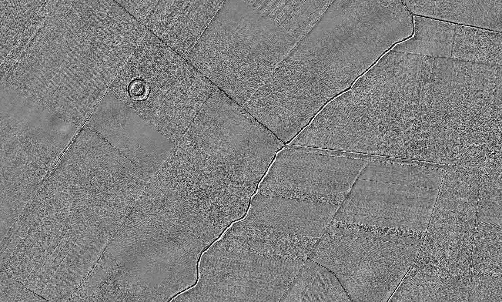
Area of interest 11 square kilometres; location Krševica. Airborne Lidar scanning and production of 3D terrain model, DSM, and orthophoto. Investor: Archaeological institute of Belgrade. (2017)
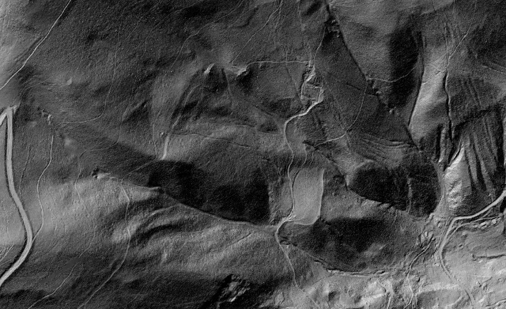
Lece
Area of interest 11 square kilometres; location Lece. Airborne Lidar scanning and production of 3D terrain model, DSM, and orthophoto. Investor: Archaeological institute of Belgrade. (2017)
Area of interest 8 square kilometres; location Radinovac. Airborne Lidar scanning and production of 3D terrain model, DSM, and orthophoto. Investor: Archaeological institute of Belgrade. (2017)
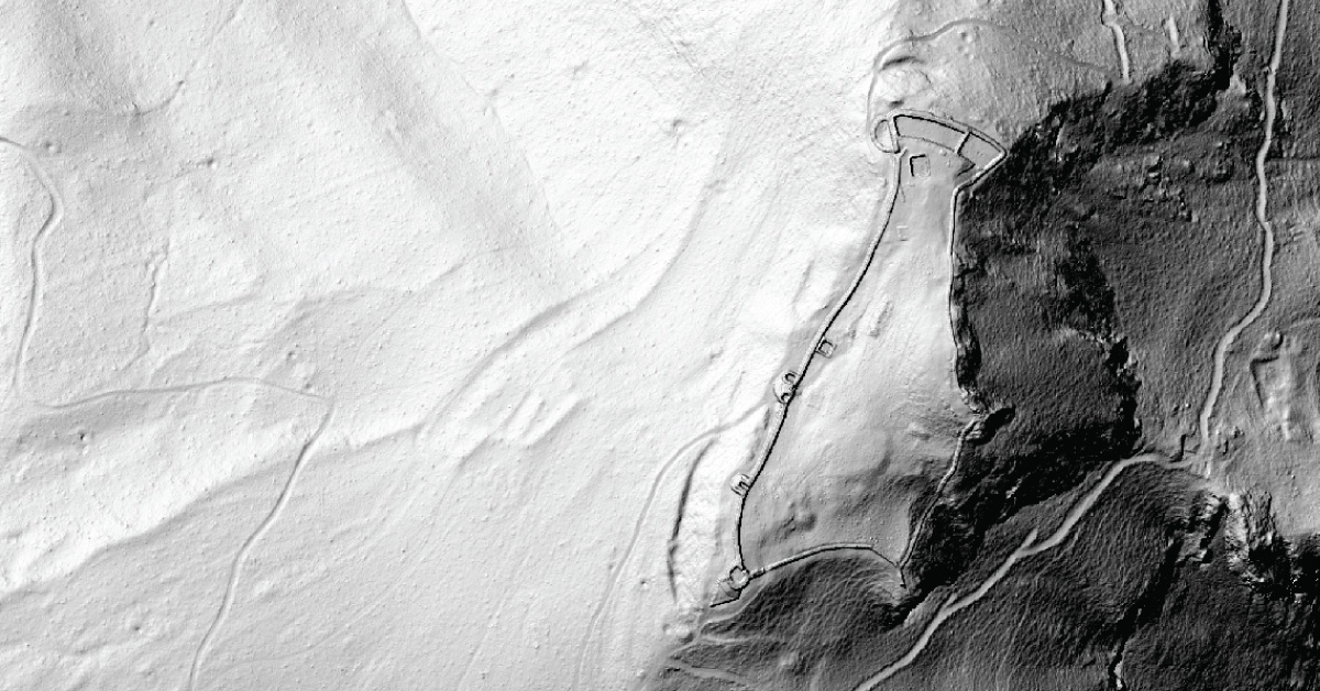
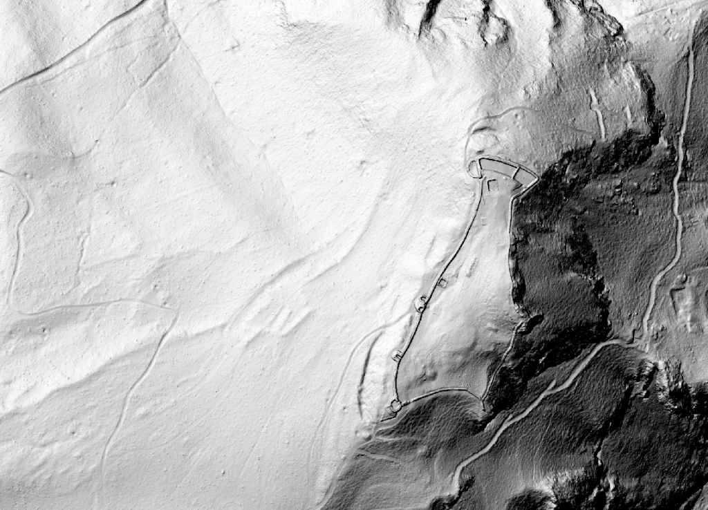
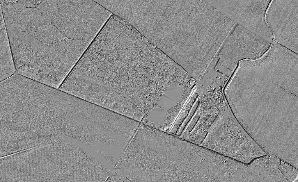
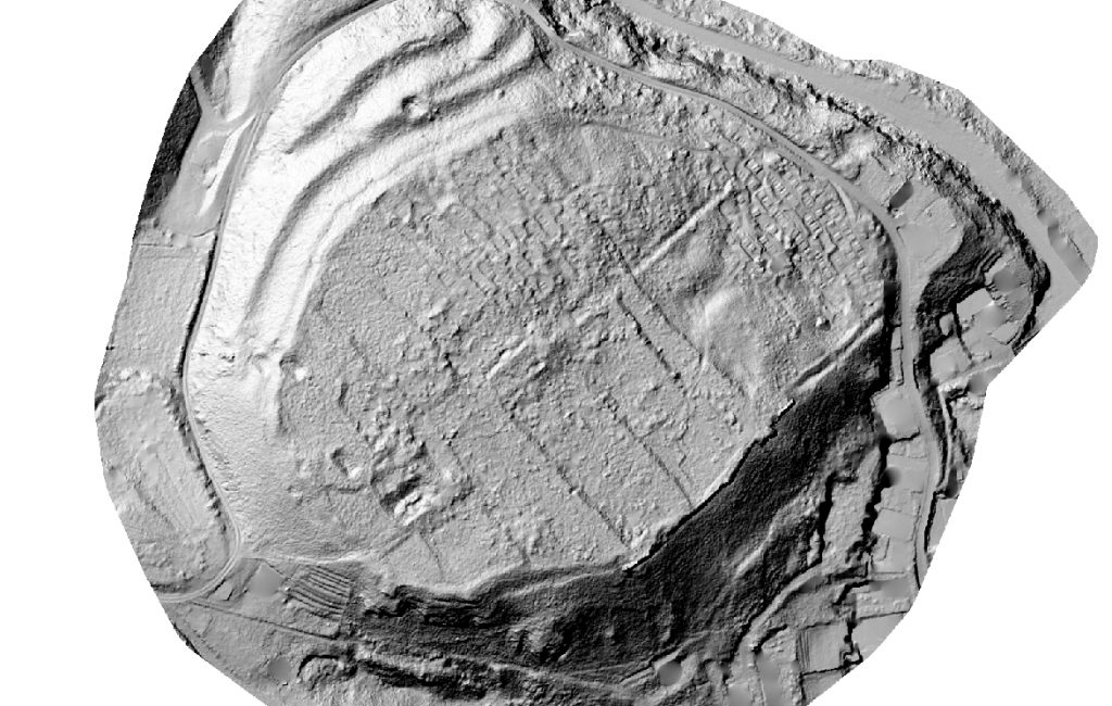
Area of interest 11 square kilometres; location Ras. Airborne Lidar scanning and production of 3D terrain model, DSM, and orthophoto. Investor: Archaeological institute of Belgrade. (2017)
Ras
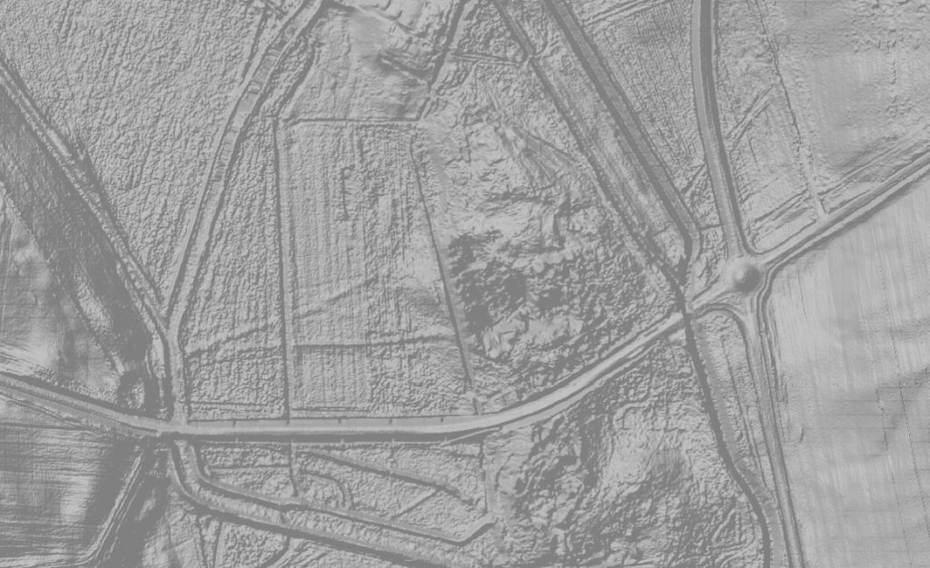
Area of interest 4 square kilometres; location Sekicol. Airborne Lidar scanning and production of 3D terrain model, DSM, and orthophoto. Investor: Archaeological institute of Belgrade. (2017)
Sekicol
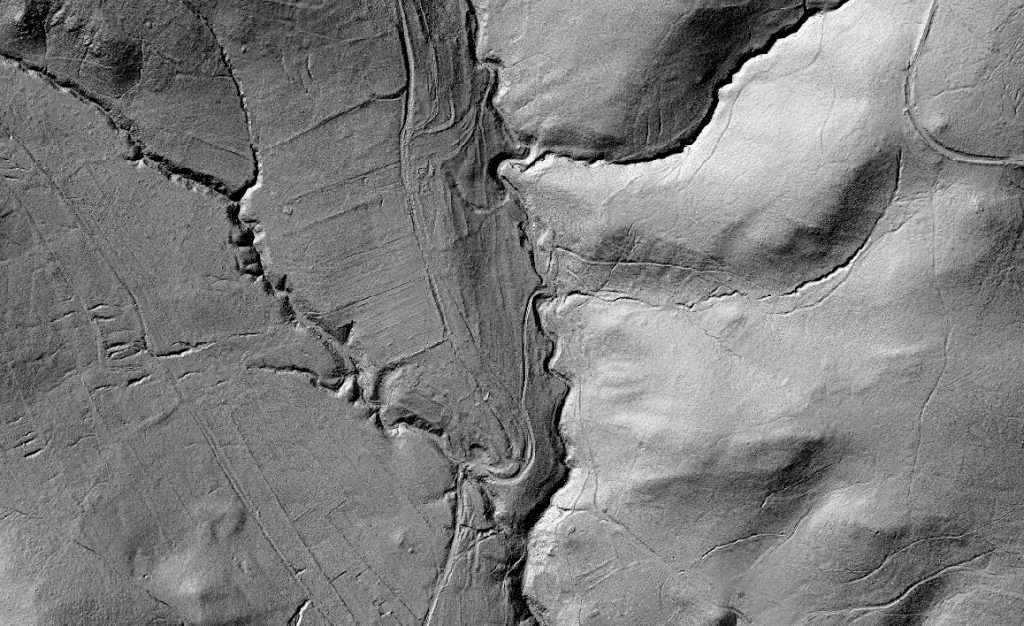
Area of interest 10,8 square kilometres; location Stalać. Airborne Lidar scanning and production of 3D terrain model, DSM, and orthophoto. Investor: Archaeological institute of Belgrade. (2017)
Stalać
Area of interest 16 square kilometres; location Lake Balaton Hungary. Airborne Lidar scanning and production of 3D terrain model, DSM, and orthophoto. Investor: Hungary. (2016)
Balaton
Area of interest 4 square kilometres; location Kosmaj. Airborne Lidar scanning and production of 3D terrain model, DSM, and orthophoto. Investor: National museum of Belgrade. (2020)
Area of interest 11 square kilometres; location Bor. Airborne Lidar scanning and production of 3D terrain model, DSM, and orthophoto. Investor: Orea Austria. (2019)
Area of interest 12 square kilometres; location Zenica. Airborne Lidar scanning and production of 3D terrain model, DSM, and orthophoto. Investor: Orea Austria. (2019)
Zenica
Area of interest 12 square kilometres, location Sremska Mitrovica. Airborne Lidar scanning and production of 3D terrain model, DSM, and orthophoto. Investor: University in Sydney. (2017)
Sremska Mitrovica
Area of interest 12 square kilometres; location Sremska Mitrovica 2. Airborne Lidar scanning and production of 3D terrain model, DSM, and orthophoto. Investor: University in Sydney. (2020)
Sremska Mitrovica
Area of interest 1 square kilometres; location Slankamen. Airborne Lidar scanning and production of 3D terrain model, DSM, and orthophoto. Investor: Institute for archaeological preservation of Sremska Mitrovica . (2019)