Airborne laser scanning measurements:
- Area of interest 150 ha location Cer, Serbia. Airborne Laser scanning measurements and production 3D terrain model and 3D maps R=1:2500 as base of this section reconstruction project and for Urban planning project. (2018)
- Area of interest 500 ha location Ovcar-Kablar, Serbia. Airborne Laser scanning measurements and production 3D terrain model and 3D maps R=1:2500 as base of this section reconstruction project and for Urban planning project. (2018)
- Area of interest 150 ha, location Prvonek lake, Serbia. Airborne Laser scanning measurements and production 3D terrain model and 3D maps R=1:2500 as base of this section reconstruction project and for Urban planning project. (2018)
- Area of interest 200 ha, location Vrutci lake, Serbia. Airborne Laser scanning measurements and production 3D terrain model and 3D maps R=1:2500 as base of this section reconstruction project and for Urban planning project. (2018)
- Area of interest 2000 ha, Location “Cukaru Peki” Bor, Serbia. Airborne Laser scanning measurements and production 3D terrain model and 3D maps R=1:2500 as base of this section reconstruction project and for Urban planning project. (2018)
- Area of interest 200 ha, location river Milesevka, Serbia. Airborne Laser scanning measurements and production 3D terrain model and 3D maps R=1:2500 as base of this section reconstruction project and for Urban planning project. (2018)
- Area of interest 1000 ha, location Zlatibor, Serbia. Airborne Laser scanning measurements and production 3D terrain model and 3D maps R=1:2500 as base of this section reconstruction project and for Urban planning project. (2018)
- Area of interest 30 km2,location archaeological site Panonia Project, Serbia. Airborne laser scanning using mobile laser scanner Riegl VUX 1 Sys and production DTM and DSM. Produced DTM were used as base for detecting archaeological artefacts covered below vegetation. (2018)
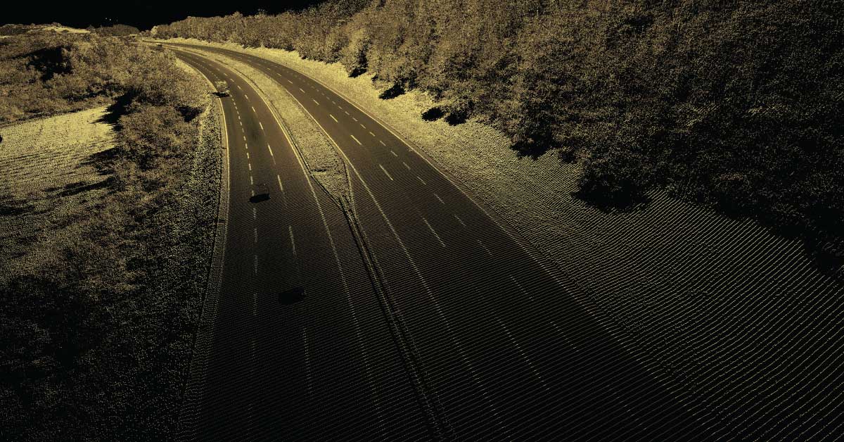
- Area of interest 240 km2,location motorway corridor Preljina – Pojate E761, Serbia. Project of determination of flood zones for motorway corridor Preljina – Pojate E761. Design and realization of surveying and mapping E761 motorway corridor with flooded area about 240 km2 using mobile Lidar and photogrammetry methodology. With computer processing of collected data were produced DTM, DSM and 3D maps for production of flood and risk map of about 140 km Zapadna Morava river valley. (2017/2018)
- Gas pipeline corridor length 135 km, location South Serbia. Design and realization of surveying and mapping gas pipeline corridor 135 km long and 1 km width using mobile LIDAR and photogrammetry methodology. With computer processing of collected data were produced DTM, DSM and 3D maps as base for planning and design activities. (2017)
- Transmission line corridor length 16 km, location Montenegro. Airborne laser scanning of transmission 35 kV line in Montenegro about 16 km long, 300 m wide and creation as built projects for pillars, cables and 3D maps of transmission line corridor. (2017)
- Location Gardos (Zemun) up to the Pupin Bridge, Serbia.Airborne laser scanning measurements, development of orthophoto and topographical maps for for Urban planning project. (2017)
- Airborne laser scanning measurements, development of DTM and DSM for Highway Project E75, section: Grdelica – Caricina Dolina (including all tunnels and bridges). (2016/2017)
- Area of interest 700 ha, location Nikola Tesla Power Plant A, Serbia. Airborne laser scanning measurements, development of topographical maps for the Urban Planning Project of Nikola Tesla Power Plant A (TENT A) with an associated landfill. (2016/2017)
- Area of interest 470 ha, location Piskanja reservoir, Serbia. Airborne laser scanning and development of DTM and DSM for the exploration Project at the site of the Piskanja reservoir. (2015/2016)
- Area of interest 25 km2, location Sekicol, Serbia Airborne laser scanning of archaeological site Sekicol using mobile laser scanner Riegl VUX 1 Sys and production DTM and DSM. Produced DTM were used as base for detecting archaeological artefacts covered below vegetation. (2016)
- Area of interest 55 km2, location Pozarevac, Serbia. Airborne laser scanning of urban area city Pozarevac (Serbia) using mobile laser scanner Riegl VUX 1 Sys and production DTM and DSM. Produced DTM and DSM were used as base for updating existing cadastral maps, detect changes in realisation urban planning projects and production new land cover maps. (2016)
- Corridor length 110 km, location Obrenovac and Jakovo, Serbia. Airborne laser scanning and development of topographical survey maps, for the project of calculation of excavation surfaces on canals near Obrenovac and Jakovo. (2016)
- Area of interest 101 ha, location Belgrade, Serbia. Airborne laser scanning and development of topographical maps for the Spatial Plan of the New Free Zone Belgrade Area. (2016)
- Area of interest 18 km2, location Baljevac, Serbia. Airborne laser scanning of urban area city Baljevac using mobile laser scanner Riegl VUX 1 Sys and production DTM and DSM. Produced DTM and DSM were used as base for updating existing cadastral maps, detect changes in realisation urban planning projects, production new land cover maps and production 3D digital maps as base for designing new mine structure and factory around the Baljevac. (2015)
- Area of interest 16 km2, location Keszthely, Hungary. Airborne laser scanning of archaeological site Keszthely (Hungary) using mobile laser scanner Riegl VUX 1 Sys and production DTM and DSM. Produced DTM were used as base for detecting archaeological artefacts covered below vegetation. (2016)
- Area of interest 25 km2, location Gamzigrad, Serbia. Airborne laser scanning of archaeological site Gamzigrad using mobile laser scanner Riegl VUX 1 Sys and production DTM and DSM. Produced DTM were used as base for detecting archaeological artefacts covered below vegetation. (2015)
- Area of interest 2400 ha, location Margum – Morava and Caricin Grad, Serbia. Airborne laser scanning of archaeological site Margum – Morava and Caricin Grad using mobile laser scanner Riegl VUX 1 Sys and production DTM and DSM. Produced DTM were used as base for detecting archaeological artefacts covered below vegetation. (2015)
- Area of interest 25 km2, location Ras, Serbia. Airborne laser scanning of archaeological site Ras using mobile laser scanner Riegl VUX 1 Sys and production DTM and DSM. Produced DTM were used as base for detecting archaeological artefacts covered below vegetation. (2015)
- Area of interest 22 km2, location Kal-Krsevica, Serbia. Airborne laser scanning of archaeological site Kal-Krsevica using mobile laser scanner Riegl VUX 1 Sys and production DTM and DSM. Produced DTM were used as base for detecting archaeological artefacts covered below vegetation. (2015)
- Area of interest 20 km2, location Stalac, Serbia. Airborne laser scanning of archaeological site Stalac (Serbia) using mobile laser scanner Riegl VUX 1 Sys and production DTM and DSM. Produced DTM were used as base for detecting archaeological artefacts covered below vegetation. (2015)
- Transmission line corridor length 215 km, location Montenegro. Airborne laser scanning of transmission 35 kV line in Montenegro about 215 km long, 300 m wide and creation as built projects for pillars, cables and 3D maps of transmission line corridor. (2015/2017)
- Area of interest 2000 ha. Aerial laser scanning and Photogrammetric imaging, DTM and DSM production for the ArchaeoLandscapes Europe Project. (2014/2015)
- Study of Flood prone area in Serbia Project supported by EU Commission in Serbia the Project “Study of Flood Prone Areas in Serbia – Phase 1” is funded by the European Union and is undertaken with support of the Delegation of the European Union to the Republic of Serbia. (2011/2012)
- Transmission line corridor length 110 km, location Kirkuk – Baiji-a Ibrahim Al Khalil, Iraq. Airborne laser scanning of the existing 132 KV transmission line from Kirkuk to Baiji-a Ibrahim Al Khalil total length of 110 km and 150 m wide corridor. 3D ortophoto maps, DTM and DSM are created on the basis of data collected for the purpose of the design of As-built drawings of the existing transmission line and for the projects of their rehabilitation in Acad environment. (2008)
- Transmission line corridor length 145 km, location border of Syria – TS Qaiem, Iraq. Airborne laser scanning of the existing 400 KV transmission line from the border of Syria to TS Qaiem total length of 145 km and 200 m wide corridor. 3D ortophoto maps, DTM and DSM are created on the basis of data collected for the purpose of the design of As-built drawings of the existing transmission line and for the projects of their rehabilitation in Acad environment. (2008)
- Transmission line corridor length 100 km, location Leskovac – Macedonian border, Serbia. Airborne laser scanning of transmission line corridor Leskovac – Macedonian border, about 100 km long, 400 m wide and creation of orthophoto plans, DTM and DSM scale of 1:2000 as the basis for design of 400 KV transmission line. (2007/2008)
- Transmission line corridor length 124 km, location Baiji – Haditha, Iraq. Airborne laser scanning of the existing 400 KV transmission line from Baiji – Haditha total length of 124.25 km and 120 m wide corridor. 3D ortophoto maps, DTM and DSM are created on the basis of data collected for the purpose of the design of As-built drawings of the existing transmission line and for the projects of their rehabilitation in Acad environment.
- Transmission line corridor length 124 km, location Hadit – TS Al Kulefa, Iraq. Airborne laser scanning of the existing 400 KV transmission line from Hadit to TS Al Kulefa total length of 124 km and 200 m wide corridor. 3D ortophoto maps, DTM and DSM are created on the basis of data collected for the purpose of the design of As-built drawings of the existing transmission line and for the projects of their rehabilitation in Acad environment. (2007)
- Transmission line corridor length 145 km, location Kirkuk to Mosul, Iraq. Airborne laser scanning of the existing 132 KV transmission line form Kirkuk to Mosul in the length of 144.96 km and 120 m wide corridor. 3D ortophoto maps, DTM and DSM are created on the basis of data collected for the purpose of the design of As-built drawings of the existing transmission line and for the projects of their rehabilitation in Acad environment. (2006)
- Transmission line corridor length 110 km, location Mosul to Ibrachem Al Khaleel, Iraq. Airborne laser scanning of the existing 132 KV transmission line from Mosul to Ibrachem Al Khaleel total length of 110.25 km and 120 m wide corridor. 3D ortophoto maps, DTM and DSM are created on the basis of data collected for the purpose of the design of As-built drawings of the existing transmission line and for the projects of their rehabilitation in Acad environment. (2006)
Airborne laser scanning measurements combined with mobile laser scanning measurements:
- Area of interest 110 km2, location Tivat – Kotor, Montenegro. Execution of a topographic recording Lidar with processing in the area of Kotor and Tivat. Design and realization of surveying and mapping 110 km2 area near Tivat and Kotor for geological investigation project, using mobile Lidar and photogrammetry methodology. With computer processing of collected data were produced DTM, DSM, orthophoto maps and 3D maps as base for geological and planning and design activities. (2018/2019)
- Area of interest 4000 ha, location city Coka, Serbia. Production of 3D terrain model and 3D maps R=1:1000 as base of this section reconstruction project. (2018)
- Area of interest 260 ha, location Bezanijska kosa – Belgrade, Serbia. Production of 3D terrain model and 3D maps R=1:1000 as base of this section reconstruction project. (2018)
- Area of interest 736 ha, location Ovca – Belgrade, Serbia. Production of 3D terrain model and 3D maps R=1:1000 as base of this section reconstruction project. (2018)
- Area of interest 87 ha, location Zrenjaninski put – Belgrade, Serbia. Production of 3D terrain model and 3D maps R=1:1000 as base of this section reconstruction project. (2018)
- Area of interest 14 ha, location Ledinci – Novi Sad, Serbia. Production of 3D terrain model and 3D maps R=1:1000 as base of this section reconstruction project. (2018)
- Area of interest 90 ha, location Vladicin Han and Surdulica, Serbia. Production of 3D terrain model and 3D maps R=1:1000 as base of this section reconstruction project. (2018)
- Area of interest 28 ha, location Vranje, Serbia. Production of 3D terrain model and 3D maps R=1:1000 as base of this section reconstruction project. (2018)
- Corridor mapping length 109.6 km, location corridor Е-761, Serbia. Production of 3D terrain model and 3D maps R=1:2500 as base of this section reconstruction project. (2018)
- Corridor mapping length 132 km, location Aleksandrovac-Tutin, Serbia. Production of 3D terrain model, orthophoto map and 3D maps R=1:2500, 1: 500, 1: 250 and 1: 100 as base for the new pipeline project. (2018)
- Corridor mapping length 34.8 km, location Badljevica-Drugovac-Malo Orasje, Serbia. Production of 3D terrain model and 3D maps R=1:1000, 1:250 as base for the new pipeline project. (2018)
- Corridor mapping length 34.7 km, location Papazovac, Serbia. Production of 3D terrain model and 3D maps R=1:1000, 1:250 as base for the new pipeline project. (2018)
- Corridor mapping length 86.4 km, location Radinac-Ralja-Lipe, Serbia. Production of 3D terrain model and 3D maps R=1:1000, 1:250 as base for the new pipeline project. (2018)
- Corridor mapping length 16.5 km, location Sivac, Serbia. Production of 3D terrain model and 3D maps R=1:1000, as a basis for the development of a new project for the installation of optical cables. (2018)
- Corridor mapping length 15 km, location Ada, Serbia. Production of 3D terrain model and 3D maps R=1:1000, 1:250 as a basis for the development of a new project for the installation of optical cables. (2018)
- Area of interest 2000 ha, location Airport “Nikola Tesla” Belgrade, Serbia. Production of 3D terrain model and 3D maps R=1:1000 as base of this section reconstruction project and Urban planning project. (2018)
- Area of interest 220 ha, location Bor, Serbia. Production of 3D terrain model and 3D maps R=1:1000 as base for new water pipeline project and Urban planning project. (2018)
- Corridor mapping length 45 km, location Valjevo, Serbia. Production of 3D terrain model and 3D maps R=1:1000 as base for new water pipeline project and Urban planning project. (2018)
- Corridor mapping length 52.85 km, location Krusevac-Adrani (road corridor E-761), Serbia. Production of 3D terrain model and 3D maps R=1:2500, 1:1000 as base of this section reconstruction project. (2018)
- Corridor mapping length 23.3 km, location highway E-763 Belgrade-South Jadran, sections Ljig-Boljkovci and Boljkovci-Takovo, Serbia. Production of geodetic survey maps as a base for the as-built project. (2017)
- Area of interest 60 ha, location Veliko selo – Belgrade, Serbia. Production of 3D terrain model and 3D maps R=1:1000 as base of this section reconstruction project. (2017)
- Area of interest 34 ha, location Topcider – Belgrade, Serbia. Production of 3D terrain model and 3D maps R=1:1000 as base of this section reconstruction project. (2017)
- Corridor mapping length 4.5 km, location part of Zrenjanin road from the Sebes canal to the North Tangent Ring road, Serbia. Production of geodetic topographical maps as a base for the Urban planning project. (2017)
- Area of interest 166 ha, location Novi Beograd – Zemun, Belgrade, Serbia. Production of 3D terrain model and 3D maps R=1:1000 as base of this section reconstruction project. (2017)
- Area of interest 500 ha, location Kumodraz – Belgrade, Serbia. Production of 3D terrain model and 3D maps R=1:1000 as base of this section reconstruction project. (2017)
- Area of interest 297 ha, location Ada-Huja, Belgrade, Serbia. Production of 3D terrain model and 3D maps R=1:1000 as base of this section reconstruction project. (2017)
- Corridor mapping length 600 km x 4 m of roads in Serbia Production of 3D terrain model and 3D maps R=1:2500 as base of this section reconstruction project. (2017)
- Area of interest 137 ha, location Nikinci, Serbia. Production of 3D terrain model and 3D maps R=1:1000 as base of this section reconstruction project. (2017)
- Corridor mapping length 23.3km x 500 m, location Dici – Takovo, Serbia. Production of 3D terrain model and 3D maps R=1:1000 as base of this section reconstruction project. (2017)
- Corridor mapping length 45.7 km, location Bac, Serbia. Production of 3D terrain model and 3D maps R=1:1000 as a base for the installation of optical cables project. (2017)
- Corridor mapping length 29.6 km, location Бачки Виногради, Serbia. Production of 3D terrain model and 3D maps R=1:1000 as a base for the installation of optical cables project. (2017)
- Corridor mapping length 11.1 km, location Crvenka, Serbia. Production of 3D terrain model and 3D maps R=1:1000 as a base for the installation of optical cables project. (2017)
- Corridor mapping length 16.1 km, location Hajdukovo, Serbia. Production of 3D terrain model and 3D maps R=1:1000 as a base for the installation of optical cables project. (2017)
- Corridor mapping length 6 km, location Karadjordjevo, Serbia. Production of 3D terrain model and 3D maps R=1:1000 as a base for the installation of optical cables project. (2017)
- Corridor mapping length 13.1 km, location Mol, Serbia. Production of 3D terrain model and 3D maps R=1:1000 as a base for the installation of optical cables project. (2017)
- Corridor mapping length 48.8 km, location Palic, Serbia. Production of 3D terrain model and 3D maps R=1:1000 as a base for the installation of optical cables project. (2017)
- Corridor mapping length 33.8 km, location Subotica, Serbia. Production of 3D terrain model and 3D maps R=1:1000 as a base for the installation of optical cables project. (2017)
- Corridor mapping length 12.8 km, location Supljak, Serbia. Production of 3D terrain model and 3D maps R=1:1000 as a base for the installation of optical cables project. (2017)
- Corridor mapping length 3.1 km, location Svilojevo, Serbia. Production of 3D terrain model and 3D maps R=1:1000 as a base for the installation of optical cables project. (2017)
- Area of interest 300 km2, Location Bor, Serbia. Design and realization of surveying and mapping 300 km2 area near Bor, for geological investigation project, using mobile Lidar and photogrammetry methodology. With computer processing of collected data were produced DTM, DSM and 3D maps as base for geological and planning and design activities. (2016/2017)
- Powerline corridor mapping length 320 km, location Montenegro. Laser scanning measurement of existing powerline corridors and production of as built project 6 sections of Montenegro electro power network. (2016-2017)
- Area of interest 330 ha, location Ada-Huja, Belgrade, Serbia. Laser scanning and development of topographical maps for the urban-architectural competition area of Ada-Huja. (2016)
- Area of interest 116 ha. Air UAV, Mobile laser scanning and precise Tachometry survey and mapping 116 hectares of Belgrade suburban area. Production 3D digital maps as base for urban planning and new bypass motor way design. (2013 – 2014)
- Area of interest 72 ha. Air UAV, Mobile laser scanning and precise Tachometry survey and mapping 72 hectares of Belgrade fortress. Production 3D digital maps as base for urban planning and utility system designing. (2013)
- Area of interest 672 ha. Air UAV, Mobile laser scanning and precise Tachometry survey and mapping 672 hectares of touristic centre Divcibare. Production 3D digital maps as base for urban planning and utility system designing. (2013)
- Area of interest 384 ha. Air UAV, Mobile laser scanning and precise Tachometry survey and mapping 384 hectares of Kopaonik – Brzece. Production 3D digital maps as base for urban planning and utility system designing. (2013)
Airborne laser scanning measurements combined with bathymetric measurements:
- Area of interest 1000 ha,location Begecka Jama, Serbia. Reducing the flood risk through floodplain restoration along the Danube River and tributaries – DANUBE FLOODPLAIN, DTP2-003-2.1 Preparation of morphological parts of 2D model for Begecka Jama pilot site (current state and 2 restoration scenarios), including related surveys and measurements. Surveying and mapping of 1000 hectares of the wider area of the Begecka Jama area at the Danube River using mobile Lidar methodology. With computer processing of collected data were produced DTM, DSM, orthophoto maps and 3D maps as base for hydrotechnical and planning design activities. (2019)
- Airborne Laser scanning and bathymetric measurements of canal corridor 33 km x 500 m on location Begej canal, Serbia and production 3D terrain model and 3D maps R=1:1000, 1:100 as base of this section reconstruction project. (2018)
- Airborne Laser scanning and bathymetric measurements, canal corridor 30 km x 500 m on location Vrbas – Bezdan, Serbia and production 3D terrain model and 3D maps R=1:1000 as base of this section reconstruction project. (2017)
- Airborne Laser scanning and bathymetric measurements, canal corridor 5 km x 500 m on location Bajski and Baracki canal, Serbia and production 3D terrain model and 3D maps R=1:1000 as base of this section reconstruction project. (2017)
- Laser scanning of Tisa river corridor 2 km wide, about 170 km length in the section from Hungarian border to the confluence of the Danube River. 3D ortophoto maps, DTM and DSM are created on the basis of data collected for the purpose of the design of As-built drawings of the existing transmission line and for the projects of their rehabilitation in Acad environment. (2011/2012)