Geodesy is a scientific discipline concerned with measuring and representing Earth, its gravitational field and geodynamical phenomena, such as: pole shifts, tides and movement of tectonic plates.
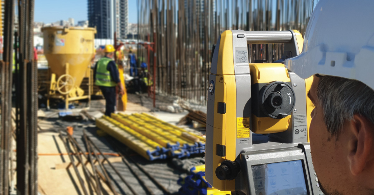
Contribution of geodesy in certain phases of engineering process (design, construction, survey, exploration, exploitation and maintenance of engineering facilities) depends on information that can be provided by the activities of surveying experts. Geodesy has been present in civil engineering since the early days, especially in realisation of complex construction projects. High standards of accuracy set as a task for engineering geodesy, apart from development of new methods, also implied application of new technologies for measuring and collection of spatial data. Development of computer technology happened in parallel with the development of new technologies, which resulted in new concepts and approaches in the processing of measurements, as well as new methods for presentation and visualisation of spatial data. New products like digital models of surfaces and terrain, orthophoto plans and images in digital format condition the increasingly wider application of computer-aided design (CAD) in designing in civil engineering.
Engineering geodesy represents a specific field within geodesy that has wide applications in all engineering disciplines, such as civil engineering, architecture, urban planning, machine engineering, shipbuilding, mining, energetics, agriculture, forestry and telecommunications.
It relates to designing and realisation of survey control networks of engineering facilities, production of geodetic survey maps for designing purposes, monitoring surveys of various structures during construction and operation, survey marking projects, production of GIS (Geographic Information Systems) of engineering facilities. Basis for production of every good-quality concept design, or main design or planning for a certain area of interest in a space are accurate and up-to-date geodetic survey maps, which create an overview of that area in space that are as real as possible. Under geodetic survey maps, we imply:
- Topographic/Layout plan,
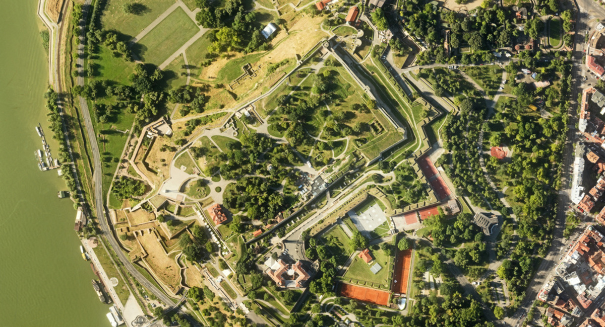
- Orthophoto,
- Digital model of the terrain,
- Digital map with required contents,
- Cadastre plan,
- Cadastre utility lines plan,
- Basic state map and other maps,
- Longitudinal profile and cross section.
Geodetic grid is defined as configuration of three or more points that are connected by survey measurement or observations. Precision of the grids depends on the precision of instruments and method of measuring, while reliability of the grids depends on the geometry of connected measured quantities in geodetic grids. Reliability and precision together create the accuracy of geodetic grid. Geodetic grids are applied as a basis for determination of dimensions, shapes and gravitational field of the Earth, survey and maintenance of Earth’s surface (Cadastre of Immovables), transfer of designed facilities, or a basis for attachment of other grids of the same or lower class.
Successful, cost-friendly and long-term operation of facilities is not possible unless designed geometry within the boundaries of set tolerances for them has not been achieved.
Other services
BIM is a resource for sharing knowledge and information regarding a building, thus forming a reliable decision-making base during its entire lifecycle.
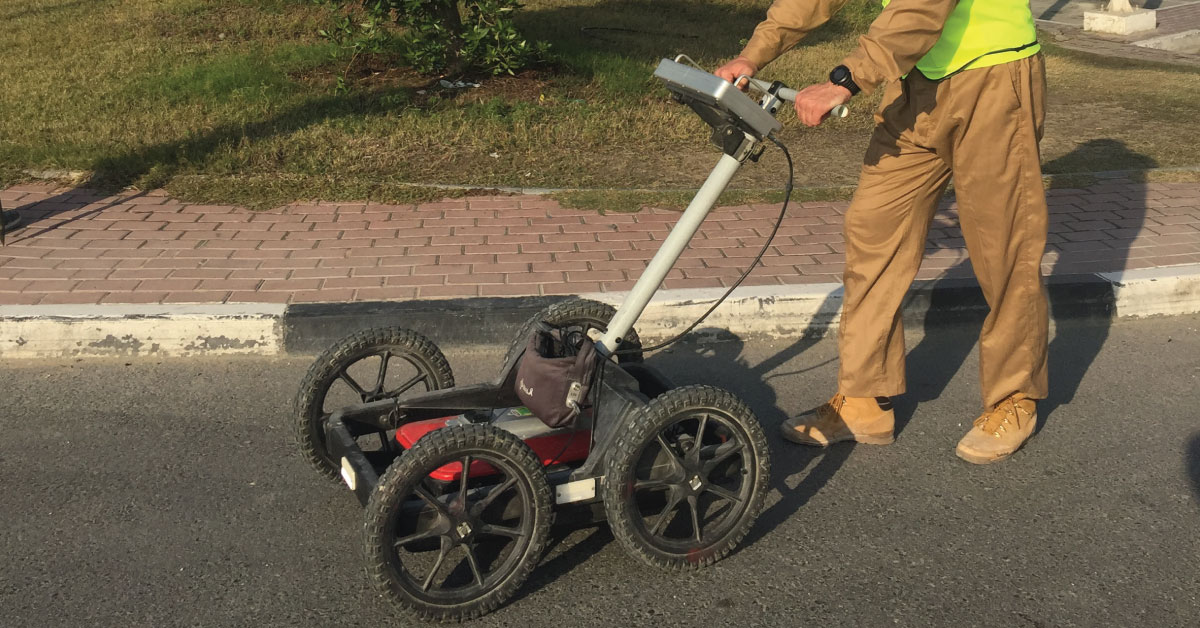
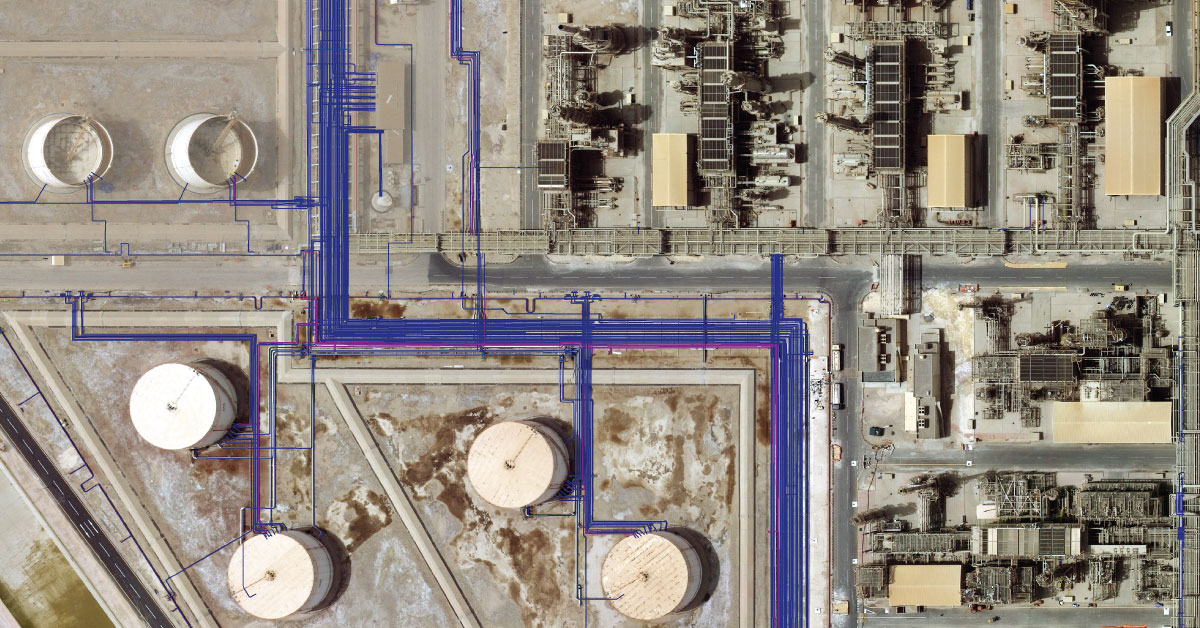
Detection of underground installations have become critical functions done before any other works. As our infrastructure network grows, the density of cables, pipelines and other installations grows as well.
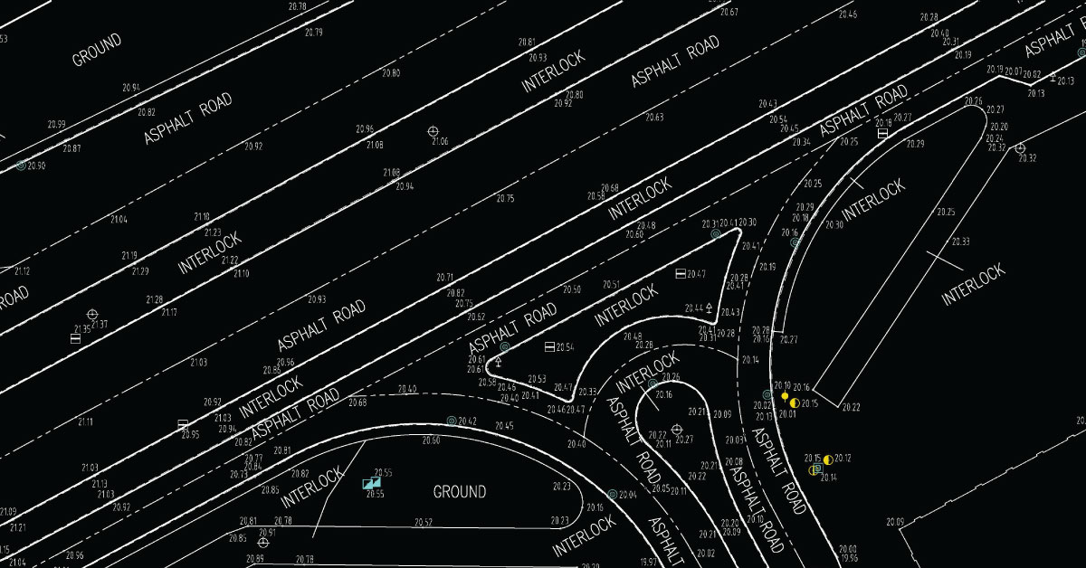
Digital topography represents geometric representation of spatial forms mapped according to corresponding geodetic and cartographic standards.
In a narrow sense, GIS is a computer system capable of integration, storage, editing, analysis and display of information related to spatial location.
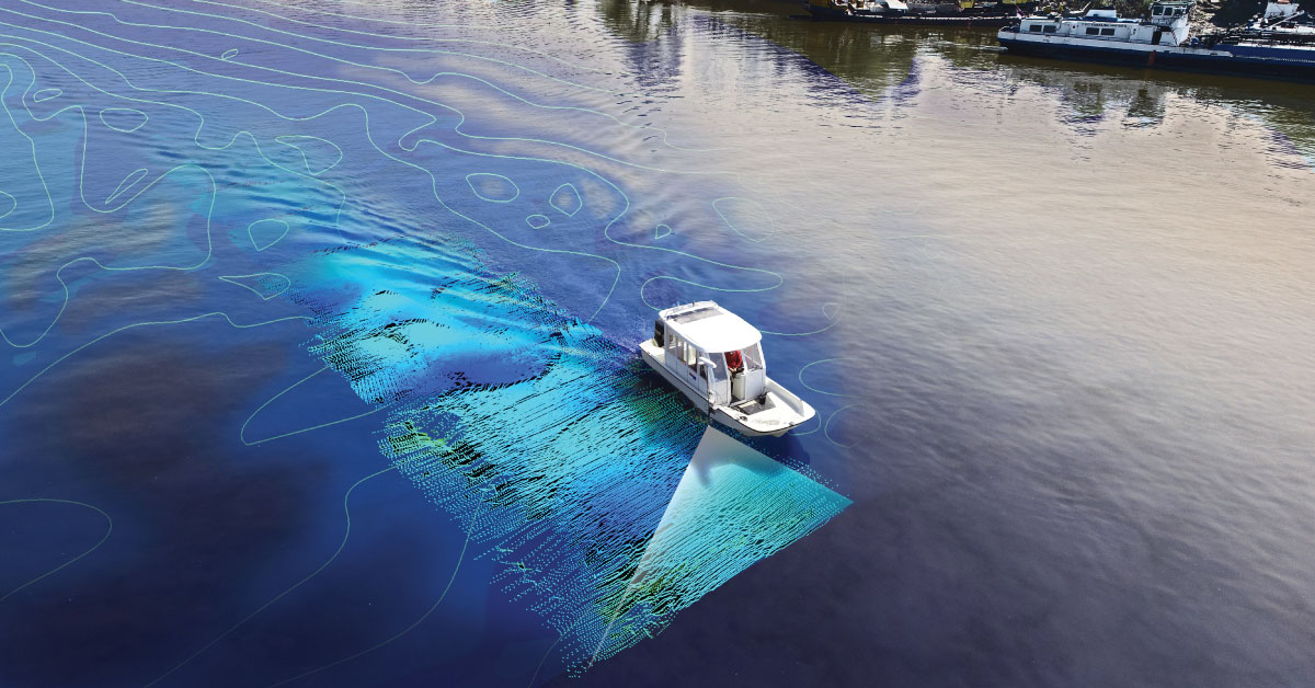
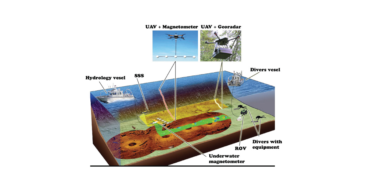
It is a branch of applied sciences concerned with measurement and description of physical characteristics of oceans, seas, coastal areas, lakes and rivers, as well as forecasting their changes over time.
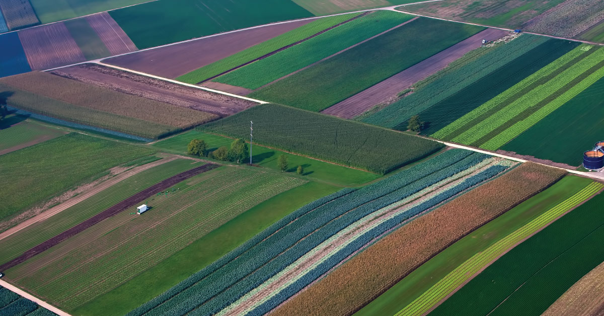
Land consolidation represents formation of larger agricultural parcels and reallocation of their ownership, whereby the number of parcels decreases and cultivation of more regular parcels is enabled.
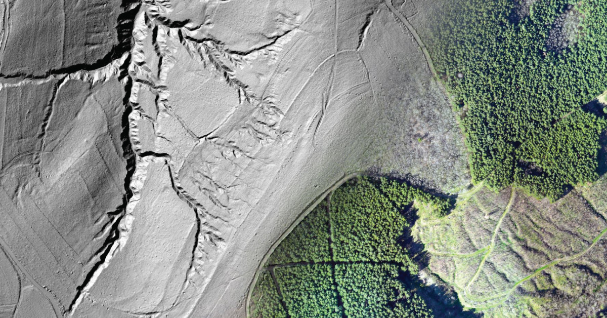
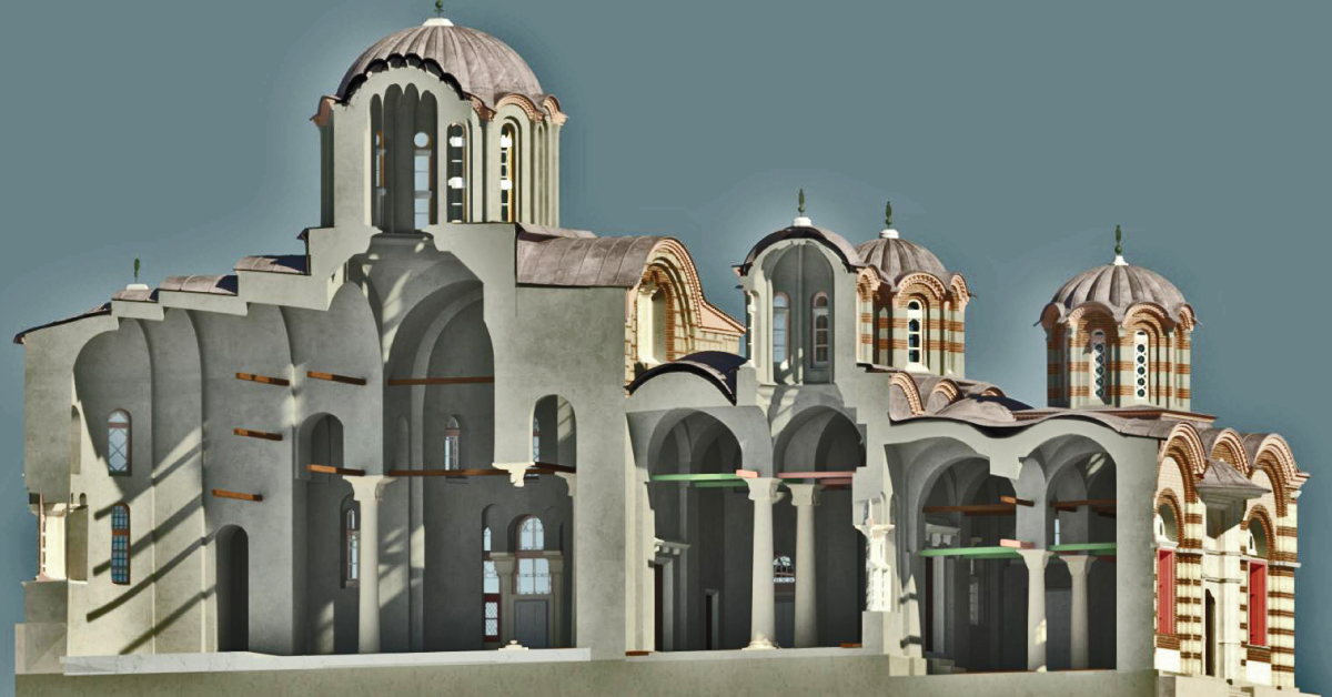
Laser scanning of terrain represents one of the most modern technologies used for mass acquisition of spatial data in the form of coordinate points in space using a laser.
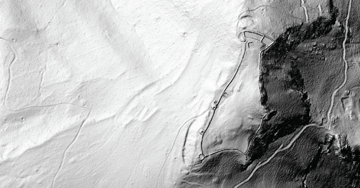
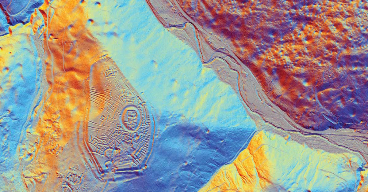
LiDAR is being used to lead a revolution in archaeology transforming how scientists understand human activity of the past.
The aim of photogrammetry is to obtain precize information regarding relief, topography of Earth’s surface, and its objects, for the purpose of producing geographic, topographic maps and plans, or 3D models.
Remote sensing represents mass geospatial data acquisition technology using systems that are not in direct physical contact with the investigated phenomenon or object .
(UXO) includes bombs, explosive devices left over from wars, explosive weapons that didn’t explode at the time they were placed and that still remain and pose a risk of detonation.