Remote sensing represents mass geospatial data acquisition technology using systems that are not in direct physical contact with the investigated phenomenon or object (aircraft/satellite sensors). Remote sensing is used for production of orthophoto plans and maps based on generated satellite images for specific area and during that process the data are collected efficiently with well laid out overview of the entirety of the examined space. It is applied in spatial planning, planning of roads and railway routes, overhead power lines, gas pipelines, creation of geoinformation systems, for geological, geophysical, environmental and various other explorations.
The carrier that a sensor is mounted on is called a “platform”. Aircrafts or satellites are used as platforms. Characteristics of a certain object can be defined using electromagnetic waves reflected or emitted by the object. The reason lies in the fact that “each object has unique characteristics of reflection or emission that differ from each other”.
In modern-day use, the term remote sensing relates, first off all, to satellite and aerial imaging. The principle of remote sensing comes down to systematic measuring of a certain energy field and interpretation of established anomalies using differences in the characteristics of the examined object. Remote sensing uses electromagnetic energy field. In its essence, it belongs to the group of geophysical exploration methods.
Passive sensors detect natural radiation emitted or reflected by observed objects or surrounding area. Reflected sunlight is the most common source of radiation measured by the passive sensors. The examples of passive remote sensors include film photography, infrared charge-coupled devices and radiometers.
On the other hand, active collection emits energy in order to scan objects and areas and then a passive sensor detects and measures the radiation that is reflected or backscattered from the target. Radar is an example of active remote sensing where the time delay between emission and return is measured, establishing the location, speed and direction of an object.
Remote sensing enables data collection in dangerous and inaccessible areas. Applications of remote sensing include monitoring of deforestation in areas such as the Amazon Basin, the effects of climate change on glaciers and Arctic and Antarctic regions, as well as depth sounding of costal and ocean depths.
Other uses include various areas of geosciences, such as natural resource management, in agriculture, land use and conservation, national security, as well as overhead, ground-based and remote collection in border areas.
Remote sensing can be used for exploration of dangerous and hardly accessible areas. Such places can be areas affected by disasters such as fires, hurricanes, etc. It is possible to perform measurements in North Pole and in the depths of the ocean and this type of exploration ensures that the surveyed places are not disturbed by man’s presence.
Use of remote sensing enables better understanding of the water movements, and in the ecological sense, spreading of contamination, whether by air or water.
Remote sensing is used for meteorological purposes, to monitor weather changes and in creation of weather forecasts, but it can also be used in various geological surveys: regional tectonic, geophysical and geotechnical surveys of mineral ore deposits and generally, in geological mapping.
Remote sensing enables faster data acquisition, lower costs and getting an overview of the entirety of surveyed space.
Remote sensing is also used during spatial planning of various regional structures, such as roads and railway tracks, overhead power lines, gas pipelines, etc. In geodesy, remote sensing is used in creation of various kind of maps.
Remote sensing is also used in production of various geographic information systems.
Satellite imaging of the movement of military troops, reconnaissance of construction of nuclear facilities and long-range missile launch facilities, discovery of performed nuclear tests and their consequences, global positioning of areas of interest, imaging of ship movements, etc. are all performed for military-security purposes.
Other services
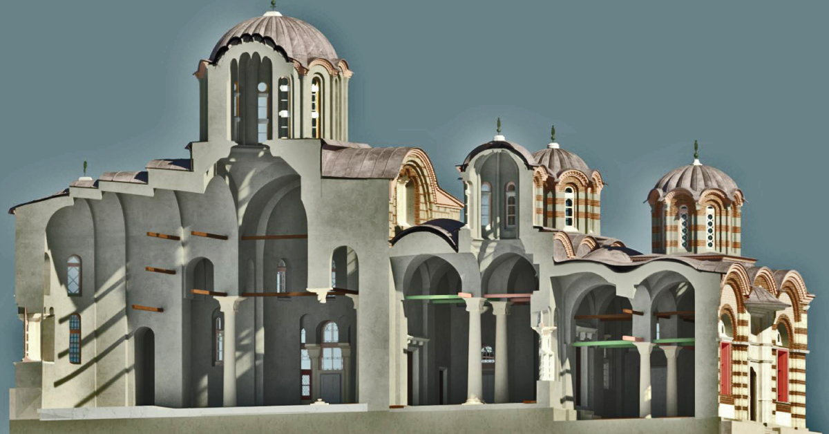
BIM is a resource for sharing knowledge and information regarding a building, thus forming a reliable decision-making base during its entire lifecycle.
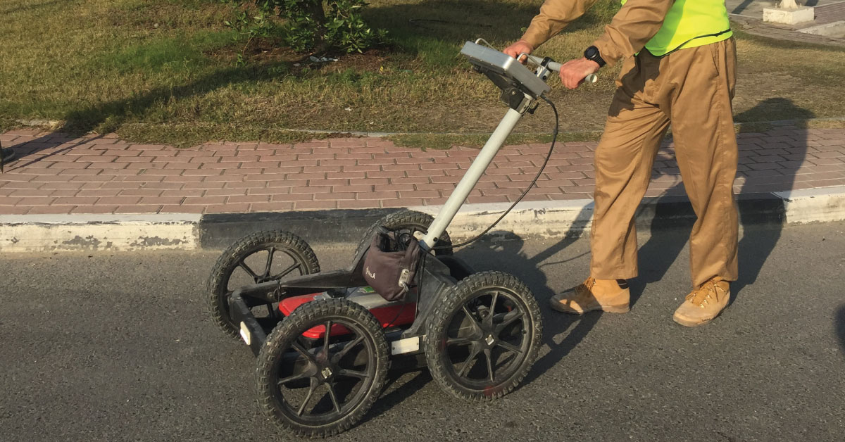
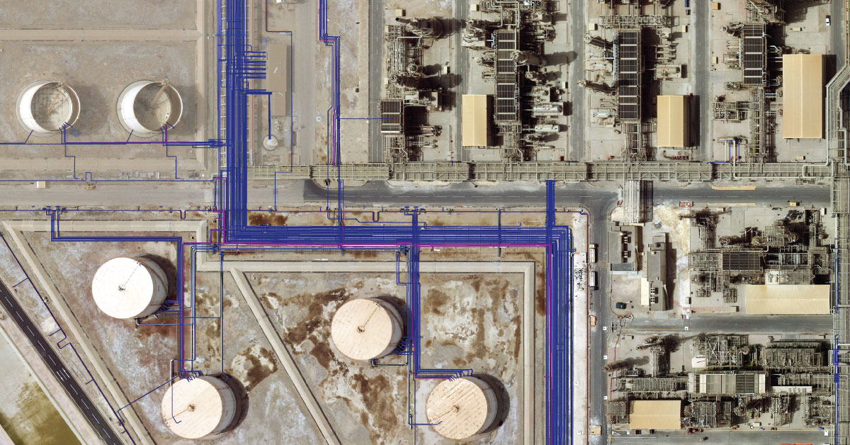
Detection of underground installations have become critical functions done before any other works. As our infrastructure network grows, the density of cables, pipelines and other installations grows as well.
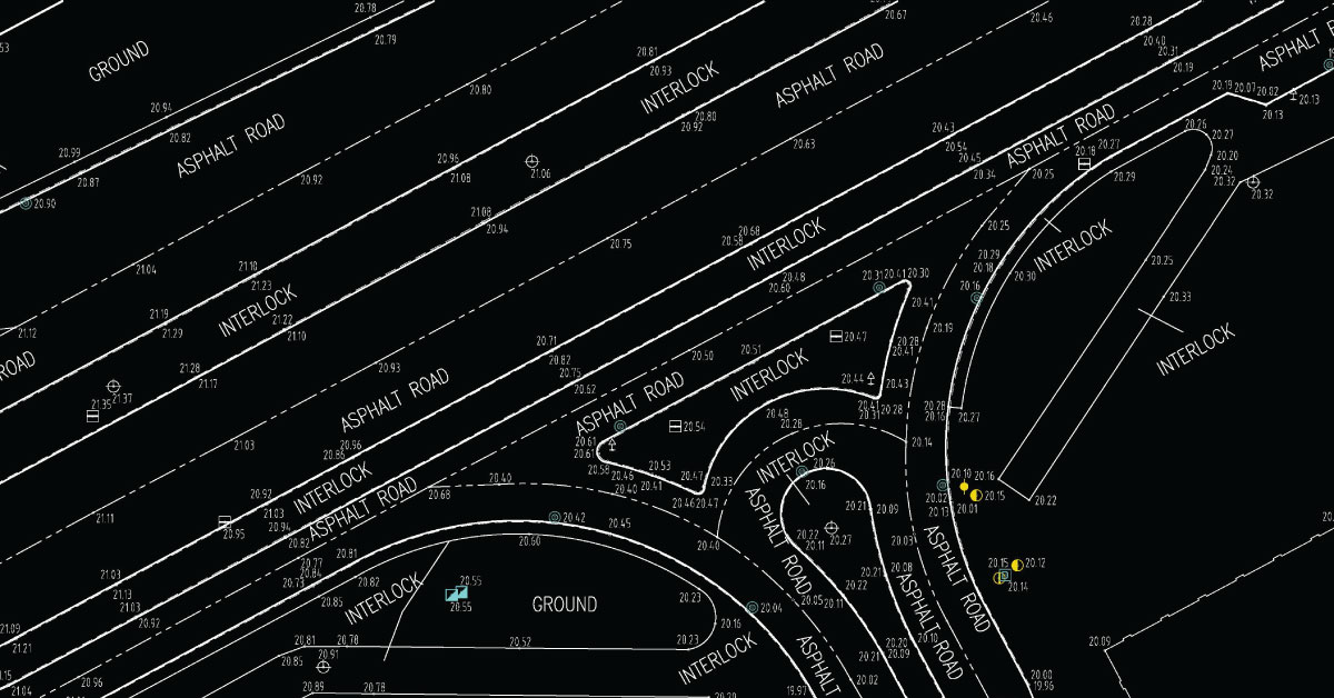
Digital topography represents geometric representation of spatial forms mapped according to corresponding geodetic and cartographic standards.
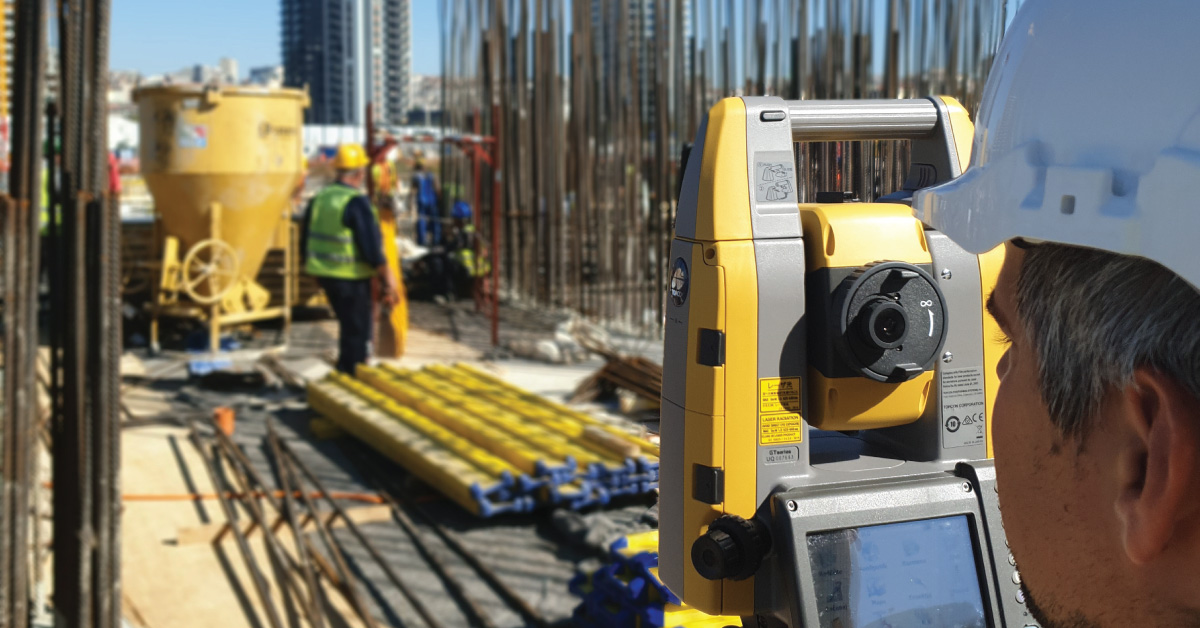
Geodesy is a scientific discipline concerned with measuring and representing Earth, its gravitational field and geodynamical phenomena, such as: pole shifts, tides and movement of tectonic plates.
In a narrow sense, GIS is a computer system capable of integration, storage, editing, analysis and display of information related to spatial location.
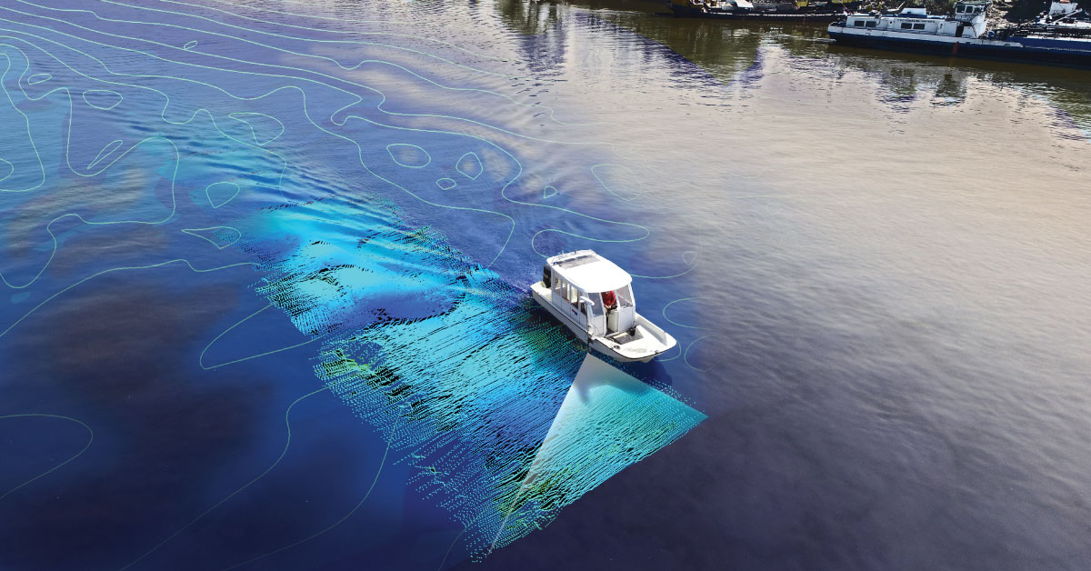
It is a branch of applied sciences concerned with measurement and description of physical characteristics of oceans, seas, coastal areas, lakes and rivers, as well as forecasting their changes over time.
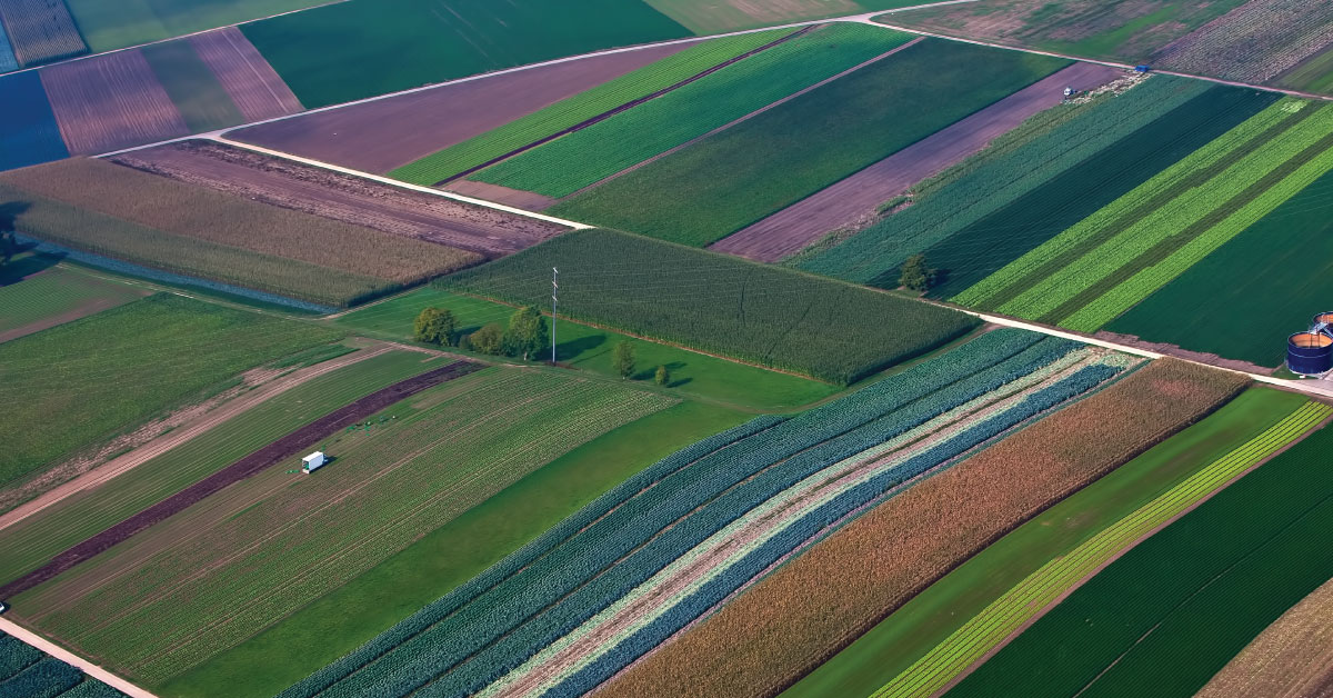
Land consolidation represents formation of larger agricultural parcels and reallocation of their ownership, whereby the number of parcels decreases and cultivation of more regular parcels is enabled.
Laser scanning of terrain represents one of the most modern technologies used for mass acquisition of spatial data in the form of coordinate points in space using a laser.
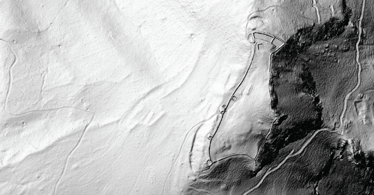
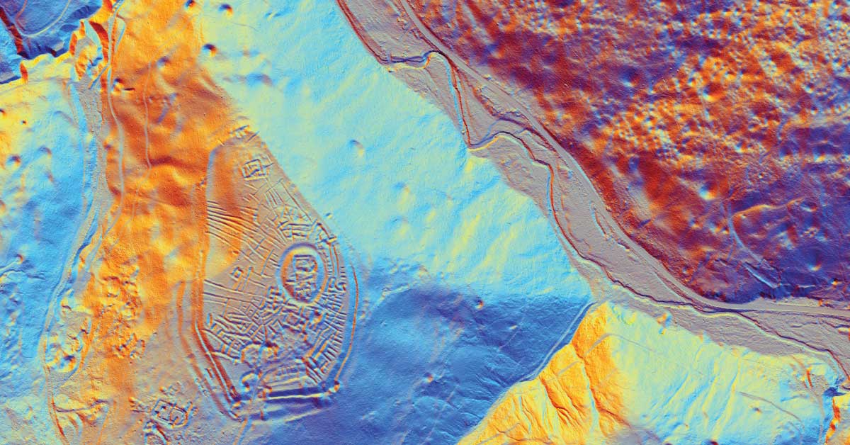
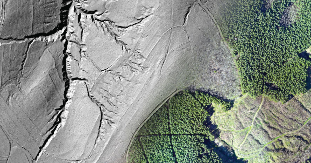
LiDAR is being used to lead a revolution in archaeology transforming how scientists understand human activity of the past.
The aim of photogrammetry is to obtain precize information regarding relief, topography of Earth’s surface, and its objects, for the purpose of producing geographic, topographic maps and plans, or 3D models.
(UXO) includes bombs, explosive devices left over from wars, explosive weapons that didn’t explode at the time they were placed and that still remain and pose a risk of detonation.