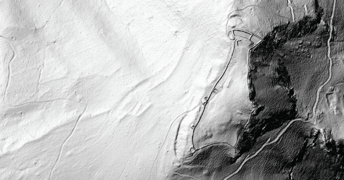
Remote sensing technology has created a dramatic shift in the past few years concerning how scientists and researchers gather and analyze information about the Earth. LiDAR is being used to lead a revolution in archaeology transforming how scientists understand human activity of the past. One of the places that LiDAR is having a significant impact is in the heavily forested areas. Flying above the forest on an aircraft, LiDAR systems emit laser pulses to measure the elevation of the ground below which alows creating detailed DSM (Digital Surface Model). LiDAR technology is capable of penetrating through the vegetation thus registering multiple targets in one laser impuls. Software is able to classify every target return and differentiate high vegetation, low vegetation, and structural remain from the ground. This approach is significantly more productive and even more detailed than trying to survey from the ground. Pointcloud classification is advanced processing using algorythms that are able differentiate structural remains from the ground using spectral data embeded in the return signal from the laser. In combination with pointcoud topology software creates subclasses of the pointcloud data. Leaving only classified ground and structural remains makes a DTM (Digital Terrain Model) in which is easy to visualise topology and visualize spreading of long lost ruins.