Photogrammetry is the art, science and technology of acquiring reliable information about physical objects and the environment through the process of recording, measuring and interpreting photographic images and models of electromagnetic radiation and other phenomena. The basis used in photogrammetry is triangulation. Lines of collimation can be developed from every camera, down to the points on the object by recording from at least two different locations. These lines intercept mathematically in order to reproduce 3D coordinates of the required points.
Measurement system for photogrammetric survey consists of sensors that contain one or more optical components for image acquisition, specially prepared measuring object and program support for analysis of captured photographs. Photogrammetric survey consists of measurement planning, marking of objects with photogrammetric marks, photographing, measuring based on photographs, processing of photographs in order to obtain 3D coordinate points and the analysis of results.
The aim of photogrammetry is to obtain information, as precisely as possible, regarding relief, topography of Earth’s surface, as well as the objects on it, and all that for the purpose of producing geographic, topographic maps and plans, or 3D models as the basis for solving numerous engineering and other scientific problems and tasks.
Photogrammetry is applied in various jobs, topographic mapping, architecture, engineering, police work, geodesy, ecology, medicine, mining, civil engineering, and meteorology to determine the speed of tornado movement, when the common meteorological methods fail.
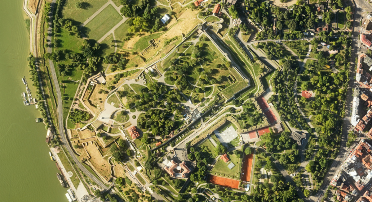
Digital orthophoto is a digital topographic map that holds a wealth of information registered on photographic image, as well as all the measuring characteristics of topographic maps and plans. By selecting adequate digital orthophoto resolution, i.e. the size of pixels on the site, enables the level of detail and accuracy required for specific purposes. On the other hand, choosing the right aircraft flight height for aerial photogrammetric survey achieves the optimal ratio between the demands for quality of digital orthophoto and its price. Digital orthophoto is an irreplaceable map for all applications that imply making an inventory of resources in space, with a very short deadline for production on the day of the survey. Photogrammetric survey is done using unmanned aircraft SenseFly eBee. The size of pixels is between 2 cm and 20 cm, camera 16MP, flight height 80 m to 170 m. Results and orthophoto plan obtained by stereo recording can be converted into a cloud of three-dimensional points in space with RGB, using which it is possible to create a topographic map with position accuracy of the size of pixels and vertical accuracy of 1,5 to 2 times the size of pixels. The results obtained by photogrammetric survey and the results obtained from the point cloud with DMT can be used for all kinds of planning and all types of spatial and urban plans.
Other services
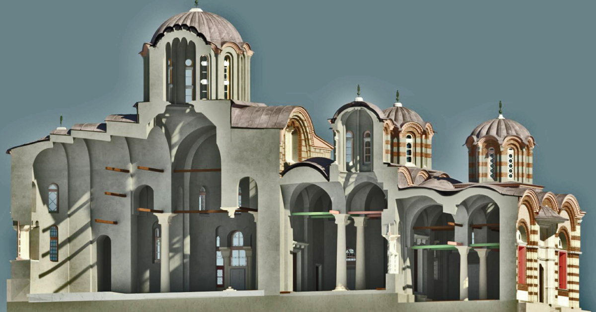
BIM is a resource for sharing knowledge and information regarding a building, thus forming a reliable decision-making base during its entire lifecycle.
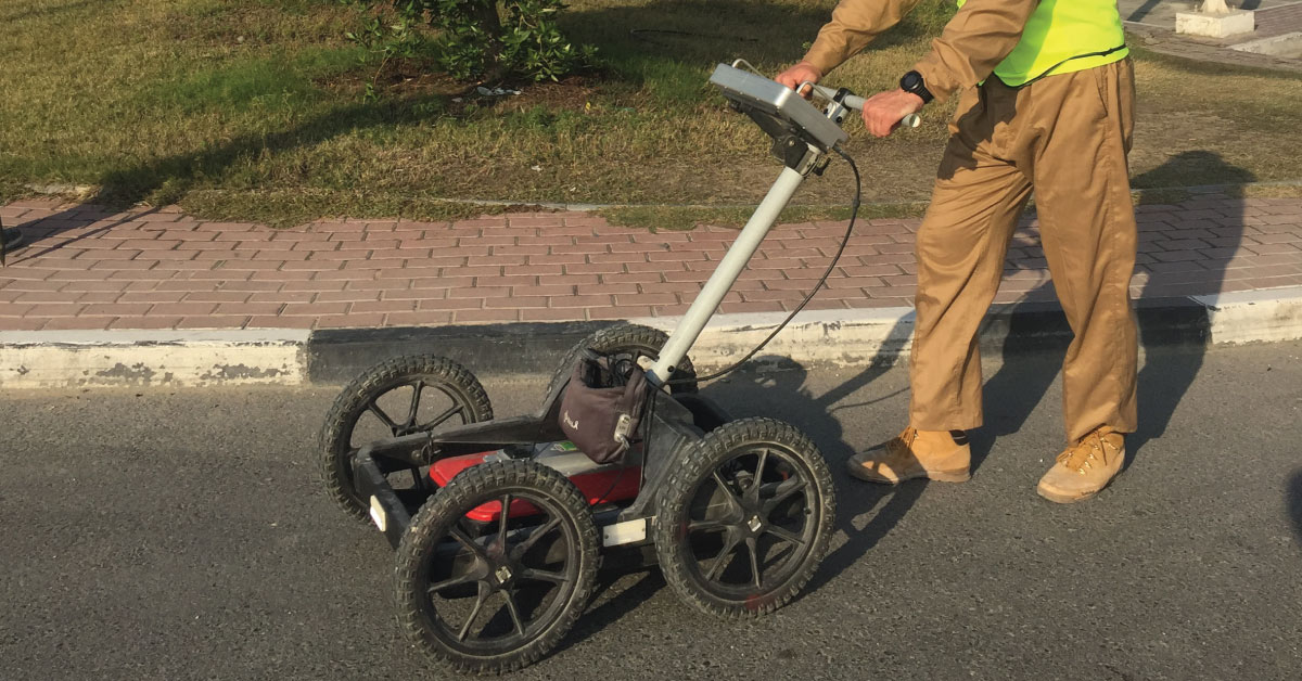
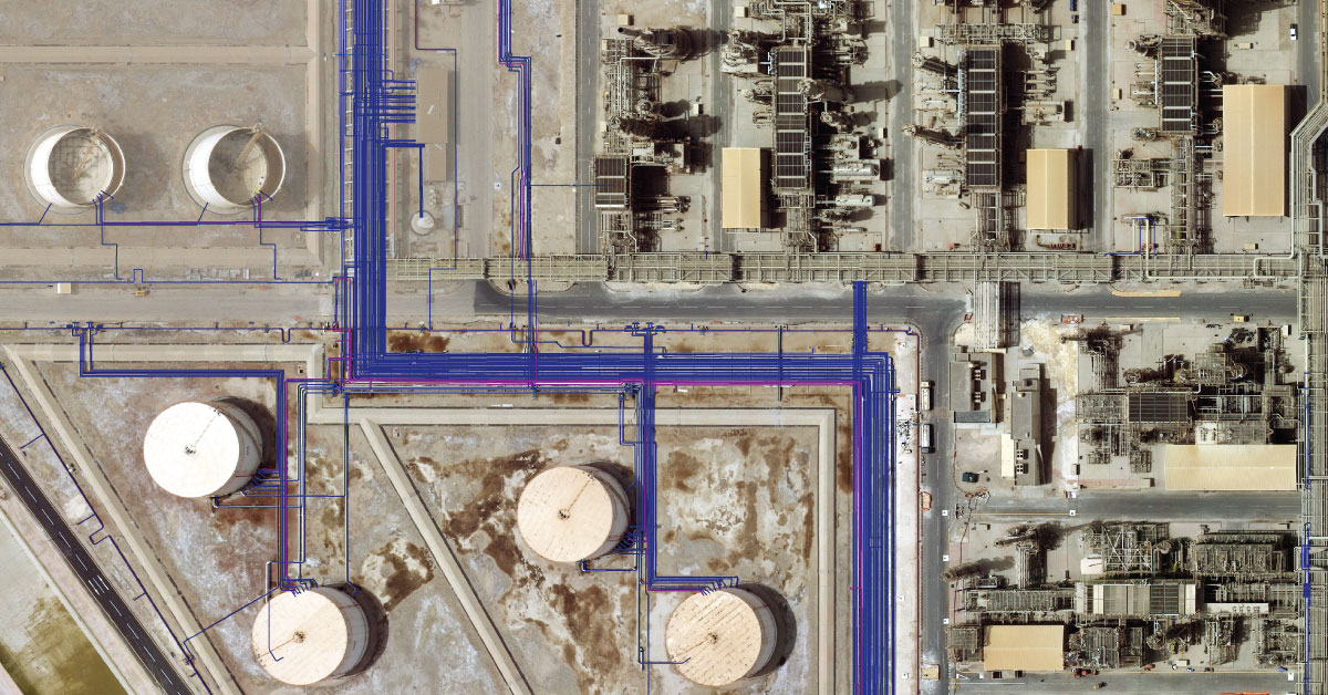
Detection of underground installations have become critical functions done before any other works. As our infrastructure network grows, the density of cables, pipelines and other installations grows as well.
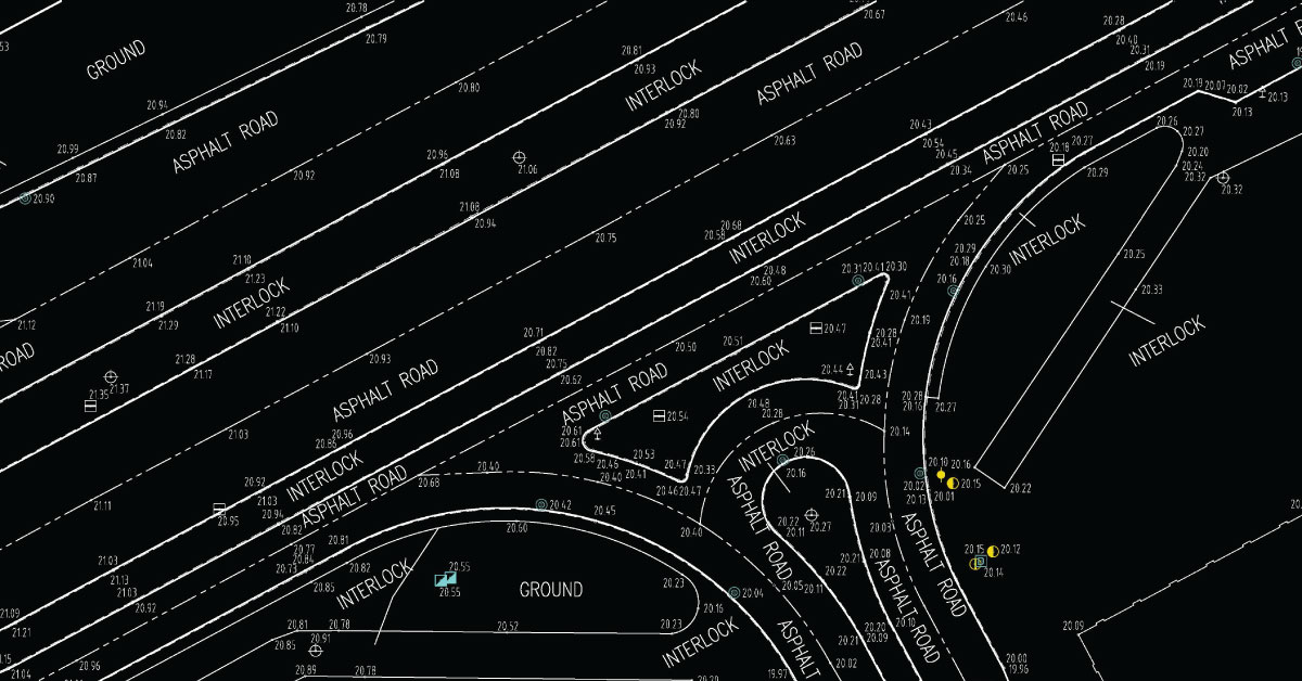
Digital topography represents geometric representation of spatial forms mapped according to corresponding geodetic and cartographic standards.
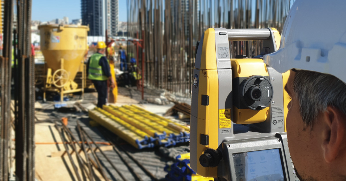
Geodesy is a scientific discipline concerned with measuring and representing Earth, its gravitational field and geodynamical phenomena, such as: pole shifts, tides and movement of tectonic plates.
In a narrow sense, GIS is a computer system capable of integration, storage, editing, analysis and display of information related to spatial location.
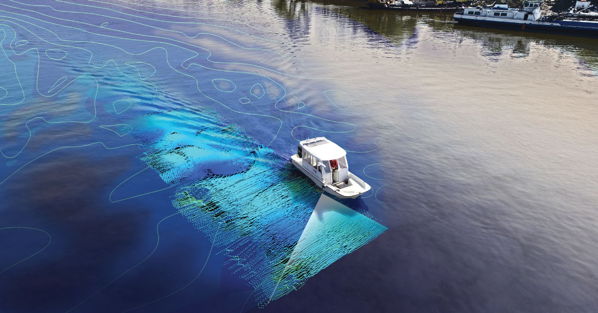
It is a branch of applied sciences concerned with measurement and description of physical characteristics of oceans, seas, coastal areas, lakes and rivers, as well as forecasting their changes over time.
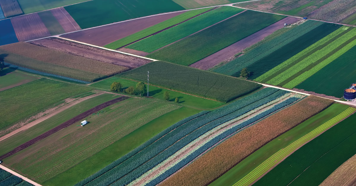
Land consolidation represents formation of larger agricultural parcels and reallocation of their ownership, whereby the number of parcels decreases and cultivation of more regular parcels is enabled.
Laser scanning of terrain represents one of the most modern technologies used for mass acquisition of spatial data in the form of coordinate points in space using a laser.
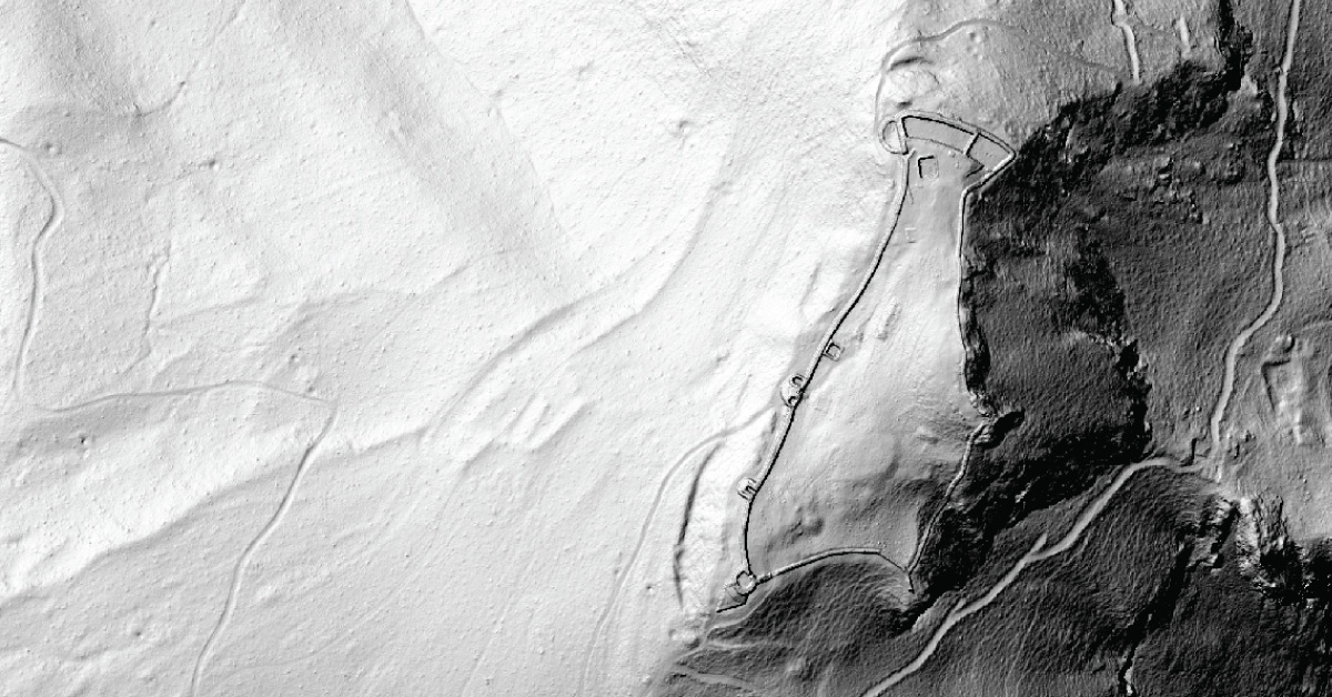
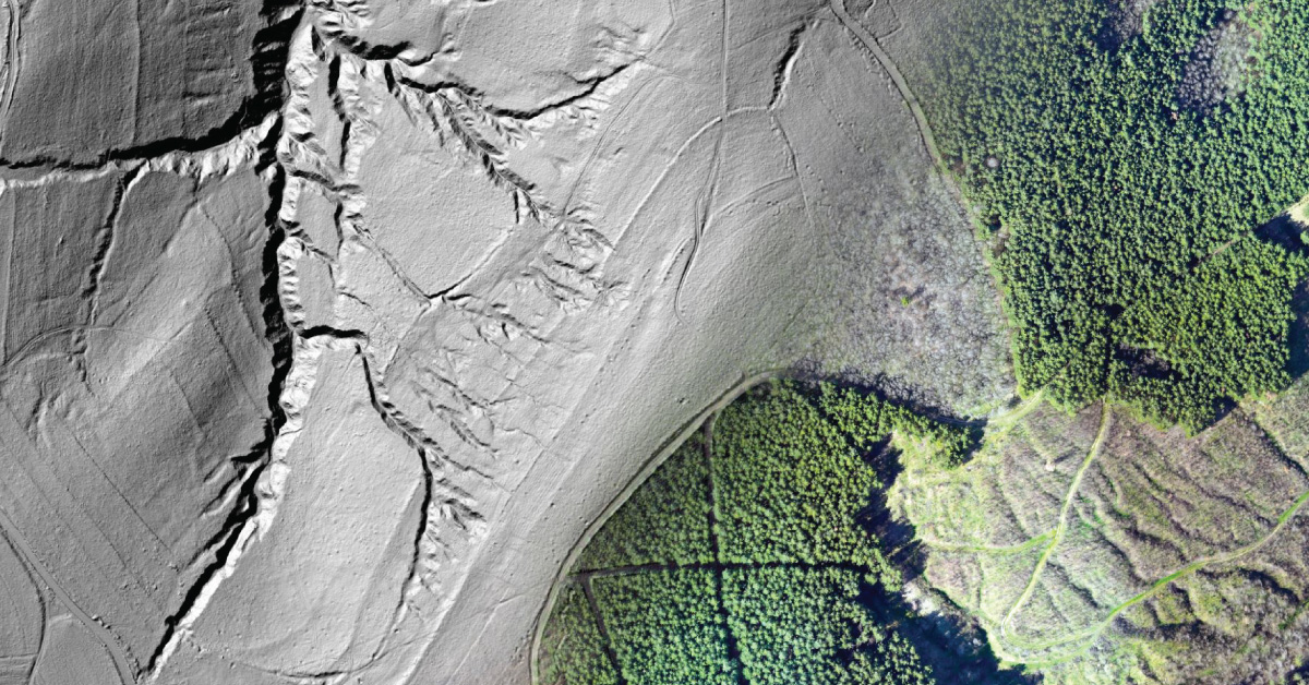
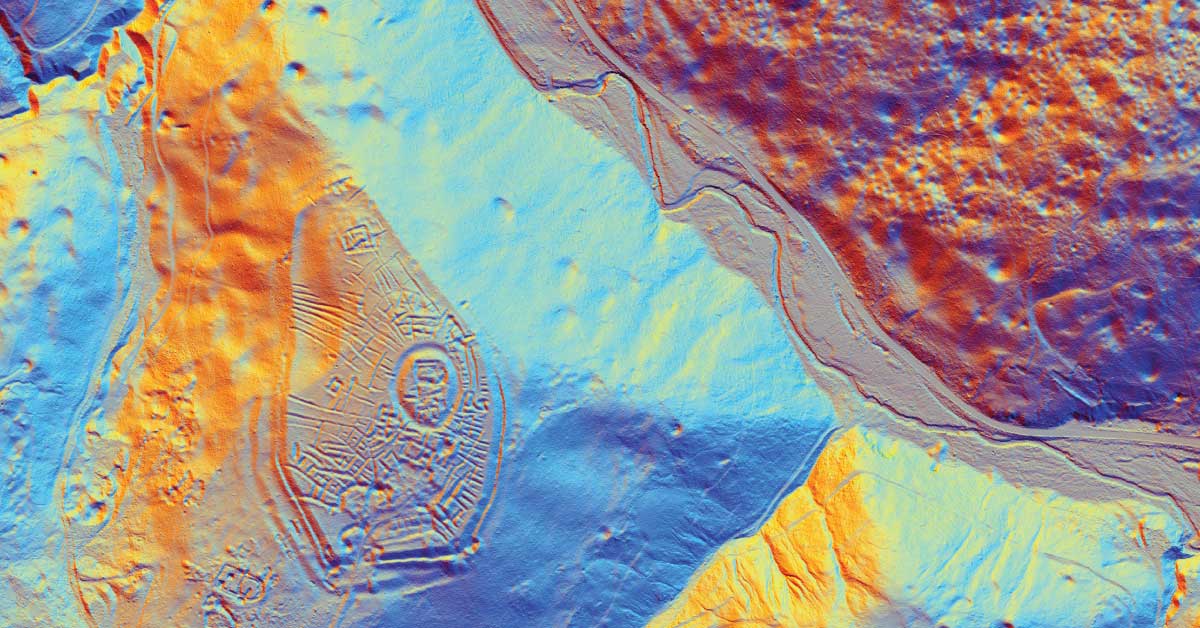
LiDAR is being used to lead a revolution in archaeology transforming how scientists understand human activity of the past.
Remote sensing represents mass geospatial data acquisition technology using systems that are not in direct physical contact with the investigated phenomenon or object .
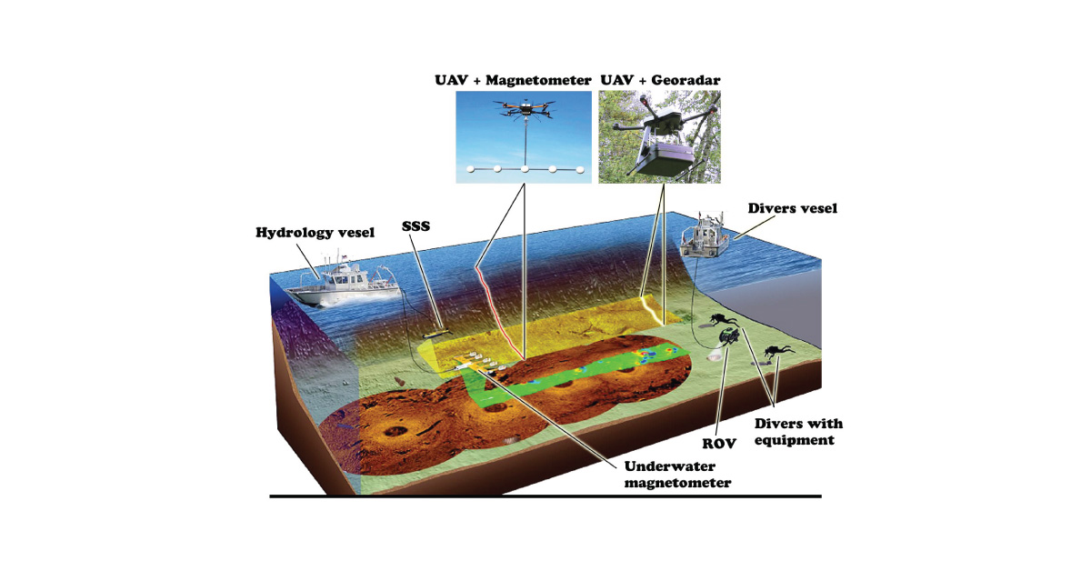
(UXO) includes bombs, explosive devices left over from wars, explosive weapons that didn’t explode at the time they were placed and that still remain and pose a risk of detonation.