Skip to content
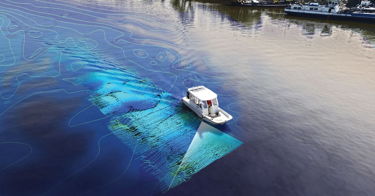
- Bathymetric survey of the bottom of the River using Multibeam Technology developing cross section profiles, calculations of the amount of excavation and the amount of the filling material erected for the Belgrade Waterfront Project. (2016 – ongoing project)
- Supervision and Environmental Monitoring of River Training and Dredging Works on Critical Sectors on The Danube River. Bathymetric Survey of seven sectors on Danube River for propose of supervision of the project. (2018 – ongoing project)
- Airborne Laser scanning and bathymetric survey, channel corridor 33 km x 500 m on location Begej canal, Serbia and production 3D terrain model and 3D maps R=1:1000, 1:100 as base of this section reconstruction project. (2018)
- Bathymetric survey using Multibeam Technology of the river bottom on the project of construction of Žeželj Bridge over the Danube River in Novi Sad, Serbia, 6 epochs of measurements were carried out (2017)
- Airborne Laser scanning and bathymetric survey, canal corridor 30 km x 500 m on location Vrbas – Bezdan, Serbia and production 3D terrain model and 3D maps R=1:1000, 1:100 as base of this section reconstruction project. (2017)
- Airborne Laser scanning and bathymetric survey, canal corridor 5 km x 500 m on location Bajski and Baracki canal, Serbia and production 3D terrain model and 3D maps R=1:1000, 1:100 as base of this section reconstruction project. (2017)
- Project of unexploded ordnance identification in the Danube River nearby the Beska Bridge (2004).
- Project of unexploded ordnance identification in the Sava River nearby the Ostruznica Bridge (2004).
- Project of unexploded ordnance identification in the Danube River nearby the town of Novi Sad (2002). In 1999, the NATO air forces destroyed three bridges across the Danube River in the town of Novi Sad. The main goal was to find the unexploded ordnances (UXOs) on the river bottom, as they presented a serious hazard for the river traffic. For these purposes, the following was used: integrated GPS, bathymetry and geophysical equipment for inspection of the river bottom to locate the submerged UXOs. Three UXOs were found and removed. For computer processing and 3D analysis were used CAD/GIS program package and methodology.